
Interactive maps of urban developments in Amsterdam
Development of interactive maps to communicate the city planning developments to the public.
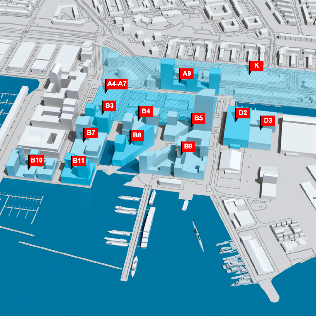
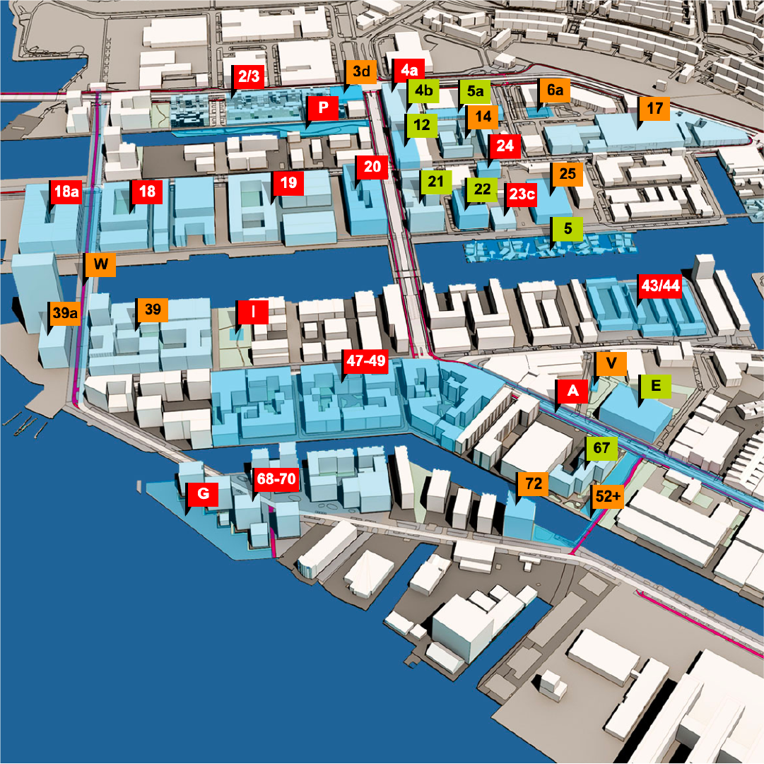
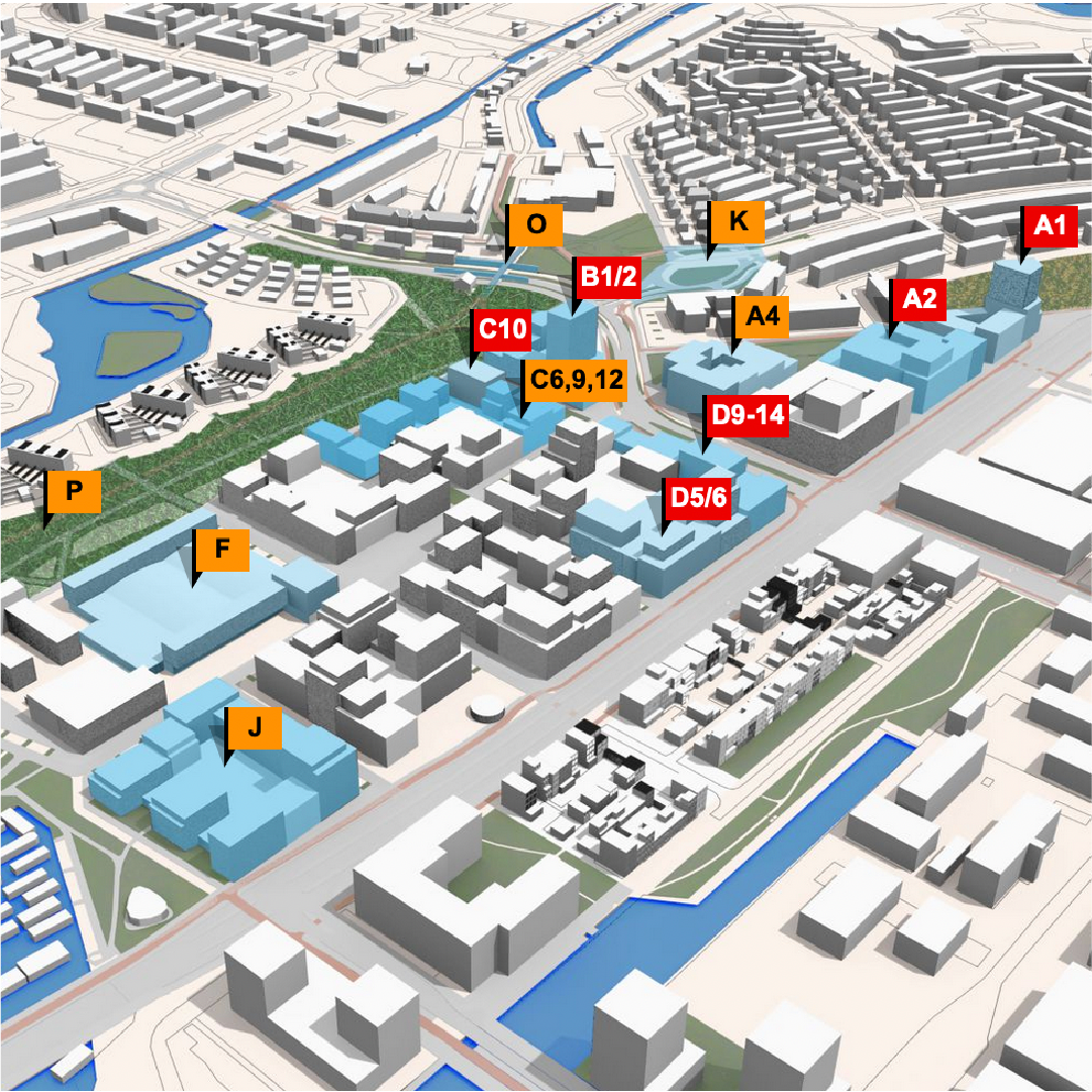
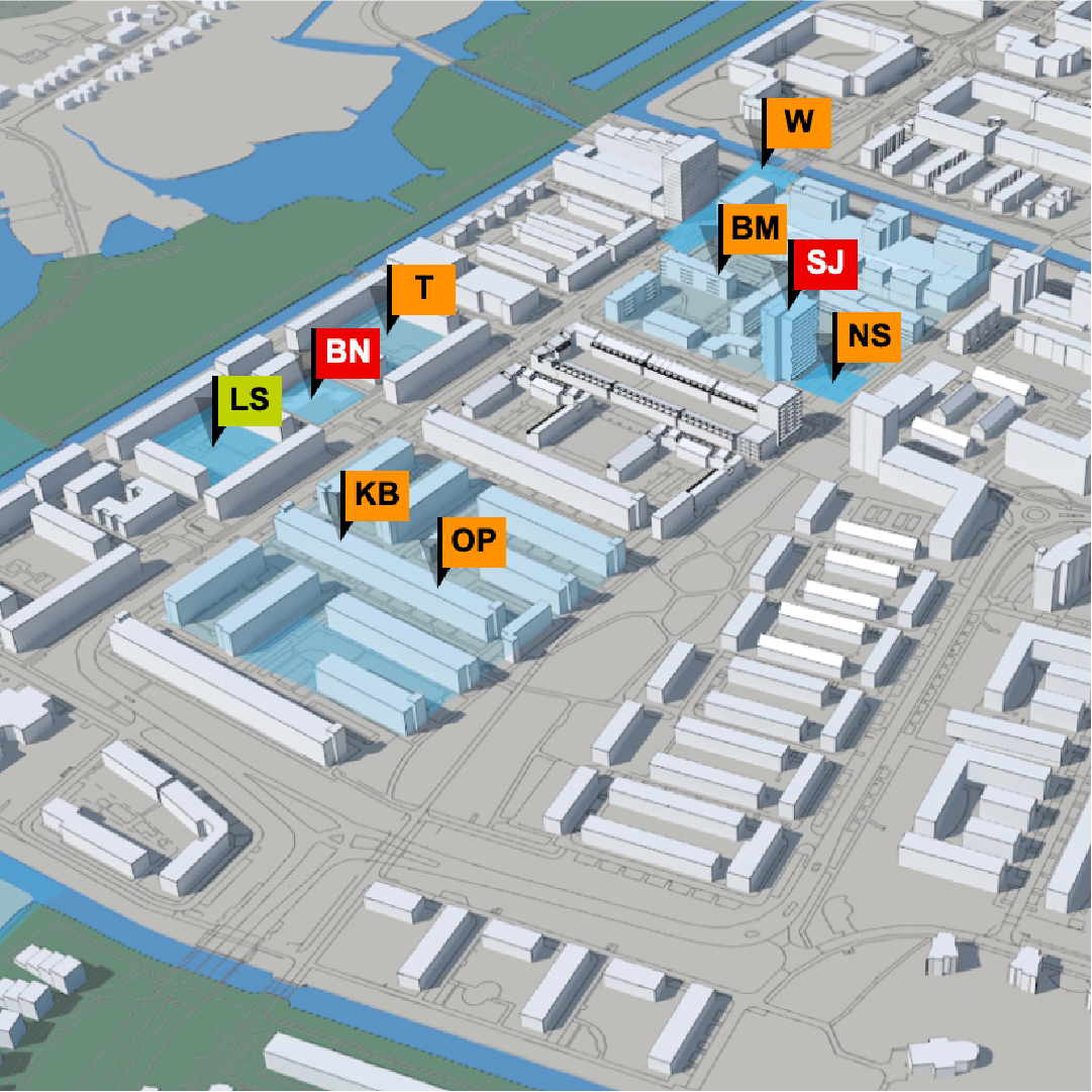
Examples of the interactive maps
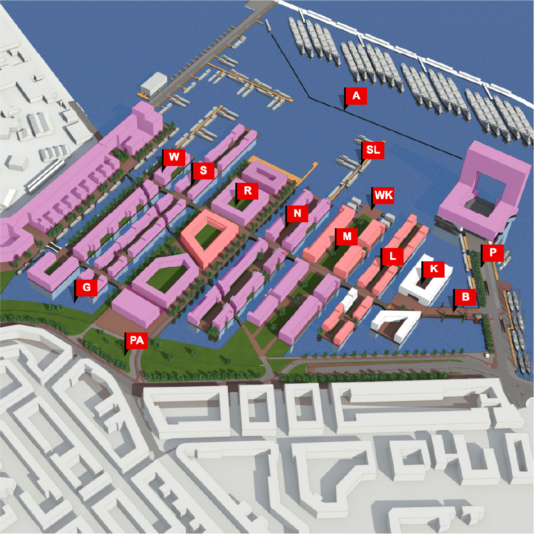
Houthaven
Buiksloterham
NDSM-werf
Overhoeks
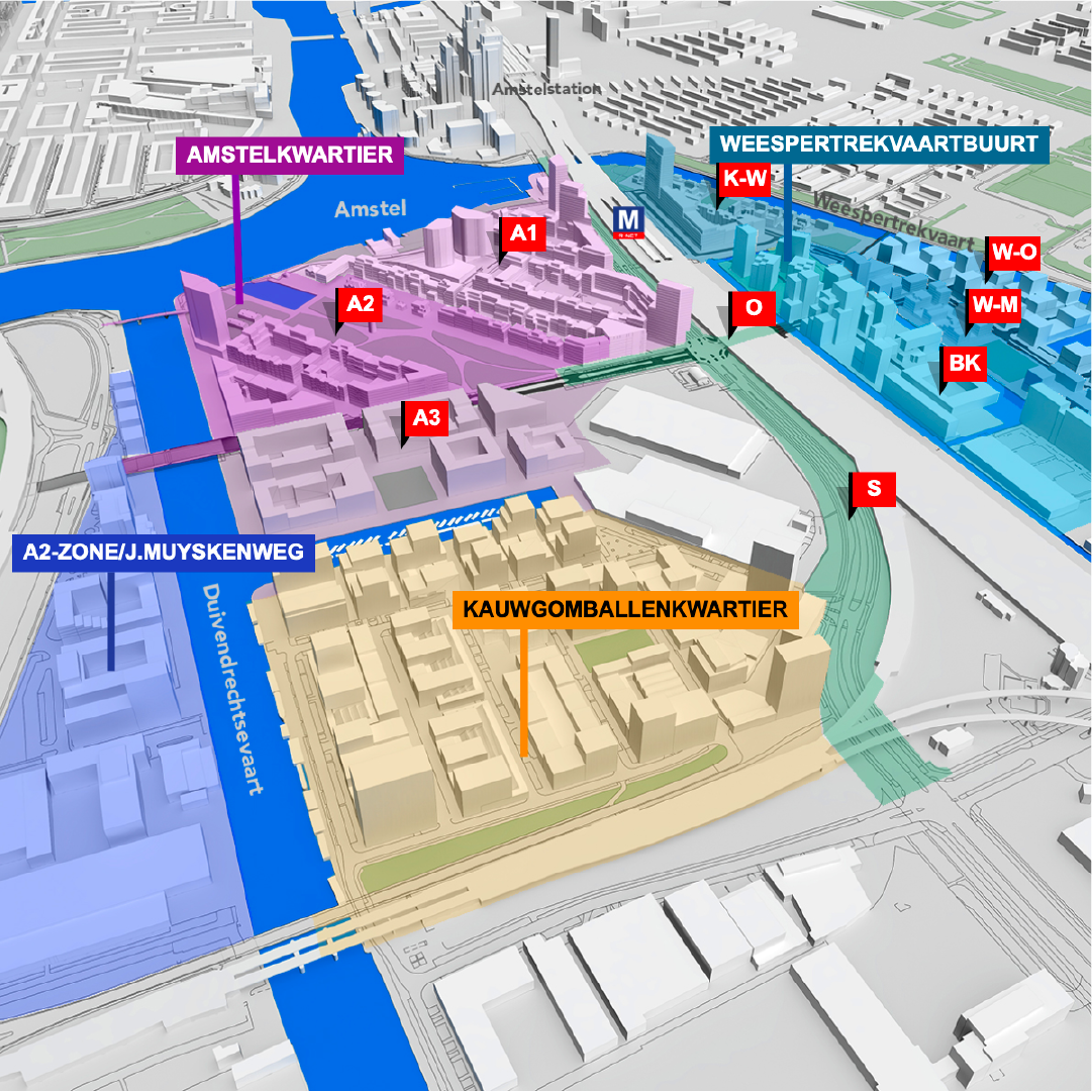
Overamstel
Sloterdijk Centrum
Arenapoort
Waterlandpleinbuurt
Klaprozenbuurt
Banne Noord
Elzenhagen Zuid
Buikslotermeerplein
Project Information
Client
Amsterdam Grond & Ontwikkeling
Type
Interaction Design
Design team
Willie van Burgsteden
in cooperation with Robert Heit (Amsterdam Beeld & Data) and the Amsterdam web project team
Technical realisation
Ronald Werring, Ypos
nomu-boba-matcha-coffeefabulous-notebooksbook-creative-processesherderfactory-brand-identityconceptbooks-studioninedotsiconic-houses-bookiconic-houses-brand-identityiconic-houses-conferencesiconic-houses-at-riskid-signature-websitehart-van-noordbasetide-recruitment-communicationparticipatie-duurzaamheid-amsterdam-noordvova-wervingtoeristic-folders-amsterdamfolder-stationsgebied-en-oosterdokeilandbuiksloterham-en-courban-signature-online-magazineinteractive-maps-of-urban-developments-in-amsterdamtimmeren-aan-het-hamerkwartierhistor-kleurkompas